

Historical Maps, For Your Walls
Every map begins as a rare historic original, carefully restored and faithfully reprinted. Mounted on linen for strength and texture, each piece is made to last for generations.
Collections
UK Counties and Cities
Continents and the World
London Maps
Countries and Empires
Cities around the World
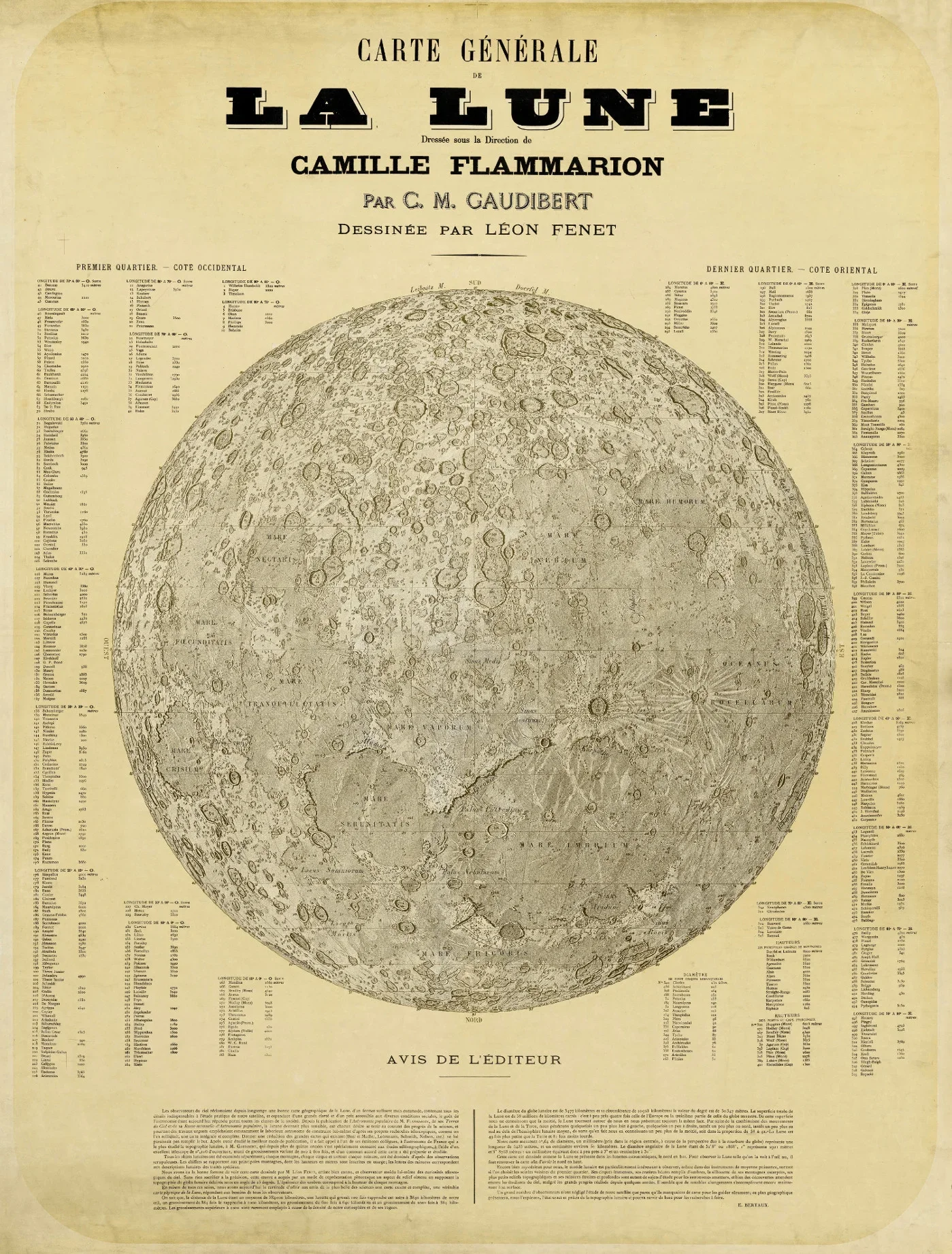
Illustrations
BEST SELLERS
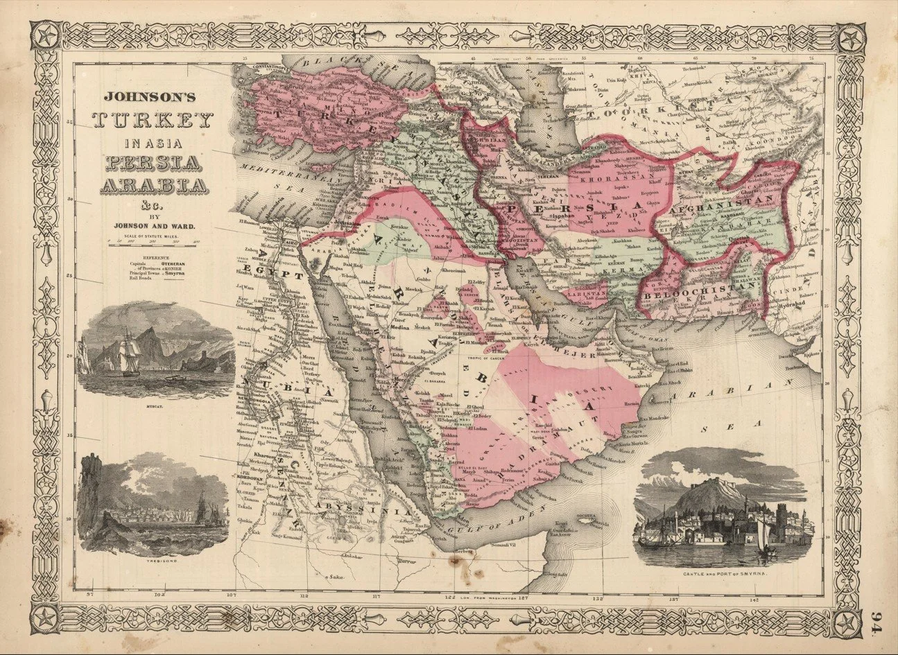
A detailed mid 19th century map of the Middle East published in 1864 by Johnson and Ward, showing a broad historical view of the region spanning from the eastern Mediterranean through Arabia and into Persia.
The map captures the area in a pre modern political landscape, with major cities, trade routes and coastal ports clearly marked alongside expansive desert interiors and mountain ranges. The Nile, Levantine coast and Arabian Peninsula are prominently featured, reflecting the region’s long standing importance in trade, religion and empire.
Each map is hand-laid on linen, enhancing durability and preserving colour over time. The linen backing also allows you to iron the reverse to remove folds and creases.
Supplied folded in a labelled, decorative package as shown in images. (Design of packaging may vary)
Available in two sizes
58 × 79cm (large)
38 × 48cm (small)
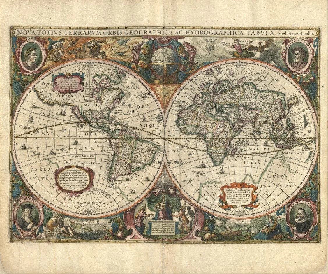
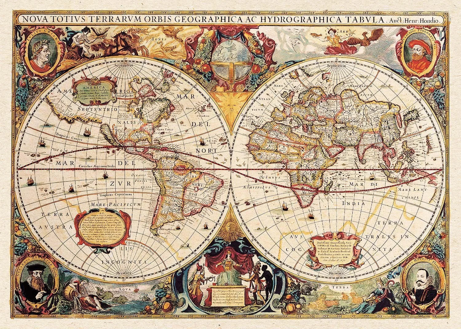
This map of the World, “Nova Totius Terrarum Orbis Geographica ac Hydrographica Tabula”, was published around 1630 by Henricus Hondius in Amsterdam.
It shows the world as understood in the early 17th century, with the Americas still developing in outline, Africa and Asia partially mapped, and large speculative southern lands reflecting the idea of Terra Australis.
Around the main map are detailed decorative borders featuring historical and scholarly figures, including Julius Caesar, Claudius Ptolemy, and Gerard Mercator, representing the classical and modern foundations of geography. The design also includes ships, sea creatures, and ornate cartouches, combining scientific mapping with rich artistic illustration typical of Dutch Golden Age cartography.
Each map is hand-laid on linen, enhancing durability and preserving colour over time. The linen backing also allows you to iron the reverse to remove folds and creases.
Supplied folded in a labelled, decorative package as shown in images. (Design of packaging may vary)
Available in two sizes
38 × 47cm
58 × 70cm
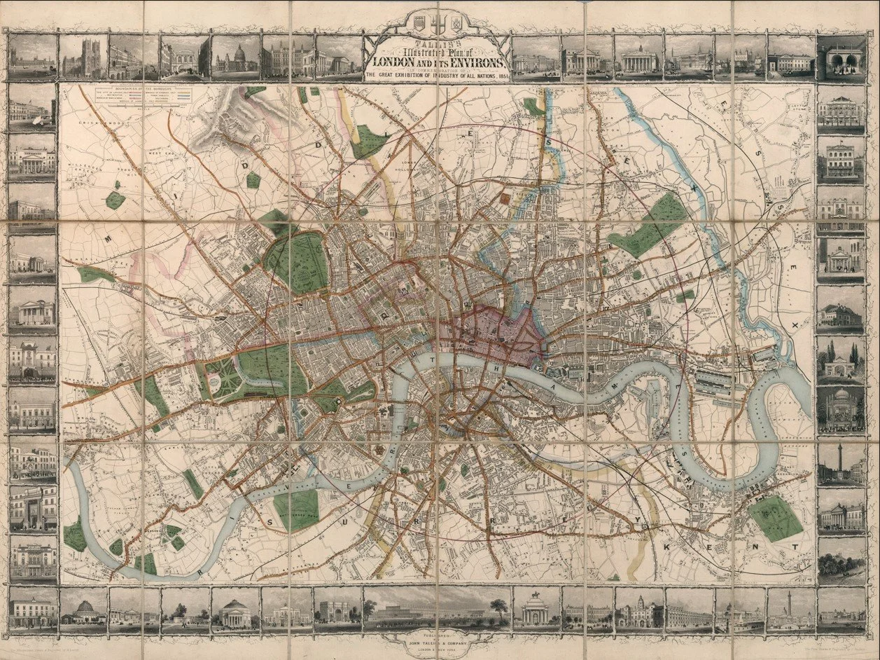
A highly decorative and detailed antique map of London published in 1851 by John Tallis, issued during the year of the Great Exhibition held at Hyde Park. It captures London at the peak of its early Victorian confidence, when the city was presenting itself as the centre of global industry, trade and innovation.
The map shows London densely packed along the River Thames, with rapidly expanding districts spreading outward into what were then still developing suburbs. Major streets, bridges and landmarks are clearly shown, giving a strong sense of a city in full motion and transformation.
What makes this map especially distinctive is its elaborate decorative border. Surrounding the map are finely engraved vignettes of London’s most important public buildings and monuments, including iconic structures such as St Paul’s Cathedral, the Houses of Parliament, Buckingham Palace and other major civic and cultural institutions. These illustrations frame the city almost like a gallery, reflecting the pride and grandeur of Victorian London during the Great Exhibition era.
Each map is hand-laid on linen, enhancing durability and preserving colour over time. The linen backing also allows you to iron the reverse to remove folds and creases.
Supplied folded in a labelled, decorative package as shown in images. (Design of packaging may vary)
Available in two sizes
36 × 49cm (small)
58 × 76cm (large)
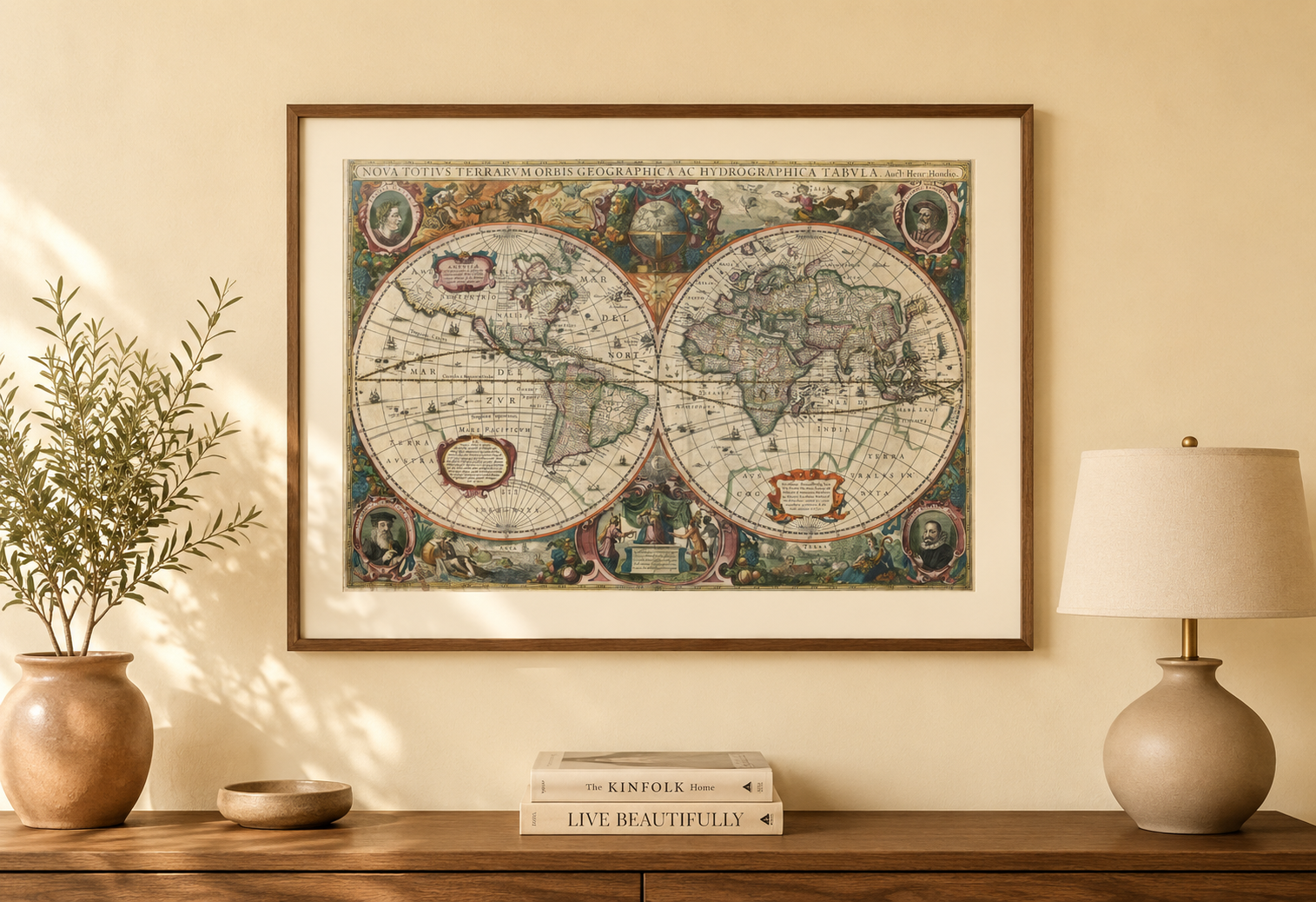
Map of the World, published in 1630 by Henricus Hondius in Amsterdam
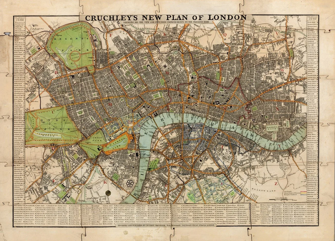
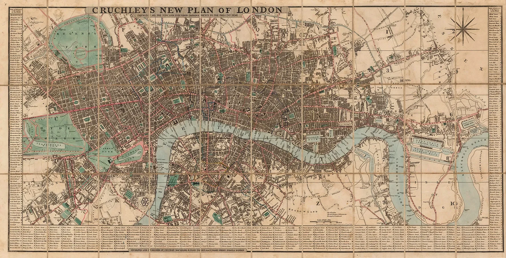
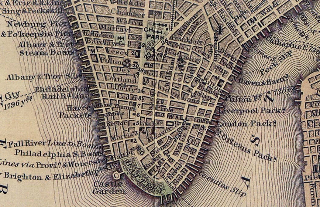
A detailed early 19th century map of London published by George Frederick Cruchley in 1833, titled Cruchley’s New Plan of London. This finely engraved plan shows the city during a key period of expansion in the early Victorian era, capturing central London before major later redevelopment.
Cruchley was known for producing clear and commercially successful maps based on earlier surveying work. This example reflects a transitional London, moving from Georgian structure into early Victorian growth.
The map shows streets, squares and districts with strong clarity, offering both historical value and decorative appeal. It presents a pre railway city layout, giving a clear sense of London before major industrial transformation.
Each map is hand-laid on linen, enhancing durability and preserving colour over time. The linen backing also allows you to iron the reverse to remove folds and creases.
Supplied folded in a labelled, decorative package as shown in images. (Design of packaging may vary)
Available in two sizes
35 × 48cm (small)
58 × 80cm (large)
Old Maps of London
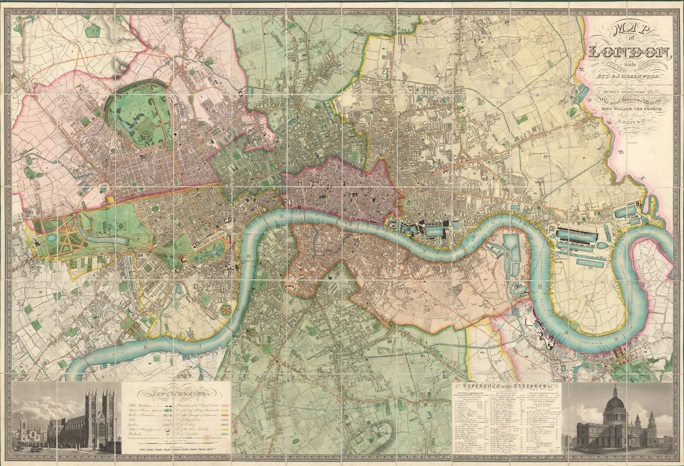
A beautifully detailed antique map of London published in 1835 by Christopher and John Greenwood, showing the city during a period of rapid growth in the early Victorian era.
This map captures London at a fascinating moment in its expansion, with the dense historic core surrounded by developing districts and open land that would later become fully built up. You can clearly make out the River Thames winding through the city, along with a rich network of streets, squares and early suburbs spreading outward.
The level of detail is striking, with every area carefully drawn in a clean, elegant style that makes it both historically interesting and visually rewarding to explore. It has a strong sense of balance between busy central London and the quieter edges of the city as it begins to expand.
Each map is hand-laid on linen, enhancing durability and preserving colour over time. The linen backing also allows you to iron the reverse to remove folds and creases.
Supplied folded in a labelled, decorative package as shown in images. (Design of packaging may vary)
Available in one size
57 × 80cm (large)
A highly decorative and detailed antique map of London published in 1851 by John Tallis, issued during the year of the Great Exhibition held at Hyde Park. It captures London at the peak of its early Victorian confidence, when the city was presenting itself as the centre of global industry, trade and innovation.
The map shows London densely packed along the River Thames, with rapidly expanding districts spreading outward into what were then still developing suburbs. Major streets, bridges and landmarks are clearly shown, giving a strong sense of a city in full motion and transformation.
What makes this map especially distinctive is its elaborate decorative border. Surrounding the map are finely engraved vignettes of London’s most important public buildings and monuments, including iconic structures such as St Paul’s Cathedral, the Houses of Parliament, Buckingham Palace and other major civic and cultural institutions. These illustrations frame the city almost like a gallery, reflecting the pride and grandeur of Victorian London during the Great Exhibition era.
Each map is hand-laid on linen, enhancing durability and preserving colour over time. The linen backing also allows you to iron the reverse to remove folds and creases.
Supplied folded in a labelled, decorative package as shown in images. (Design of packaging may vary)
Available in two sizes
36 × 49cm (small)
58 × 76cm (large)